If you're planning to develop land with trees on or near your site, understanding tree survey requirements can mean the difference between planning approval and costly rejection. My Topographic Surveyor UK has conducted tree surveys for hundreds of planning applications across the United Kingdom, and we know exactly what planning authorities need to see.
In this comprehensive guide, we'll explain when you need a tree survey, what BS5837 standards require, how tree preservation orders affect development, and how experienced surveyors document trees to satisfy planners and protect valuable trees during construction.
Why Planning Applications Require Tree Surveys
Local planning authorities across the United Kingdom take trees seriously. Trees provide environmental benefits, improve air quality, support wildlife, and enhance property values. Planning systems protect trees through regulations that require developers to consider arboricultural impacts before permission is granted.
My Topographic Surveyor UK works with planning applicants who need professional tree surveys that demonstrate how their development:
- Identifies and assesses all trees on site and within influencing distance
- Evaluates tree quality, health, and remaining lifespan
- Shows which trees can be retained and which may need removal
- Proposes protection measures for retained trees during construction
- Demonstrates compliance with BS5837:2012 standards
Without professional tree surveys meeting BS5837 requirements, planning applications for sites with significant trees face rejection or expensive delays while applicants commission proper surveys.
Understanding BS5837:2012 Standards
BS5837:2012 "Trees in relation to design, demolition and construction - Recommendations" is the British Standard that governs tree surveys for planning purposes. My Topographic Surveyor UK's experienced surveyors are trained in BS5837 methodology, ensuring tree surveys meet planning authority expectations.
What BS5837 Tree Surveys Include
A BS5837 compliant tree survey from My Topographic Surveyor UK documents every tree and woodland group on your development site, including:
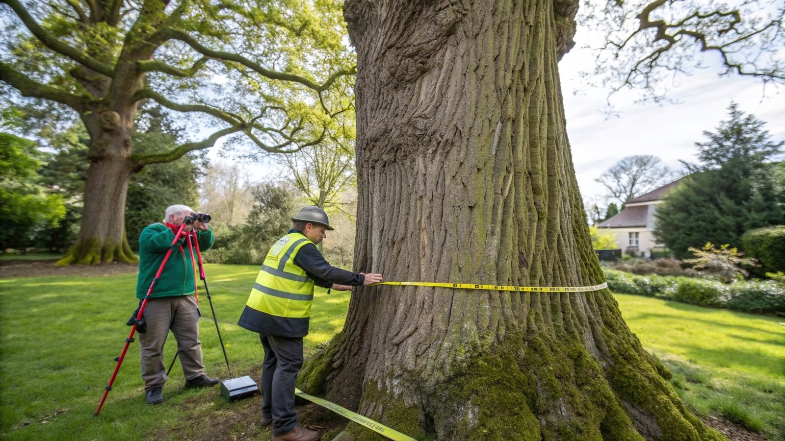
- Tree locations: Precise positions measured by experienced land surveyors using GPS and total stations
- Species identification: Common and Latin names for all trees
- Measurements: Trunk diameter (DBH), height, and canopy spread
- Health assessment: Physiological and structural condition evaluation
- Life expectancy: Estimated remaining lifespan categories (10+, 20+, or 40+ years)
- Quality categorization: BS5837 categories (A, B, C, or U) based on retention value
BS5837 Tree Category Classifications
The standard categorizes trees by retention value, helping planners and developers prioritize tree protection:
- Category A (Green): High quality trees with 40+ years life expectancy. These trees should be retained.
- Category B (Blue): Moderate quality trees with 20+ years life expectancy. These trees should be retained where possible.
- Category C (Grey): Low quality trees with 10+ years life expectancy. These can be considered for removal.
- Category U (Red): Poor condition trees in terminal decline or dangerous. These should be removed regardless of development.
Planning authorities expect developers to design around Category A and B trees, demonstrating that high and moderate value trees are protected.
Tree Preservation Orders (TPOs) and Conservation Areas
Tree Preservation Orders and Conservation Areas add legal protection to trees, making tree surveys even more critical for planning applications. My Topographic Surveyor UK helps developers navigate TPO requirements.
What Are Tree Preservation Orders?
Tree Preservation Orders are legal designations that protect specific trees or groups of trees. Under TPO protection:
- You need local authority consent before pruning, cutting down, or damaging protected trees
- Unauthorized work on TPO trees can result in unlimited fines or criminal prosecution
- Planning applications affecting TPO trees face additional scrutiny
- TPO trees must be shown on tree surveys with their TPO reference numbers
Experienced surveyors from My Topographic Surveyor UK check local authority records to identify TPO trees and ensure tree surveys correctly document protected status.
Conservation Area Considerations
In Conservation Areas, additional tree protections apply:
- Trees over 75mm diameter (at 1.5m height) have automatic protection
- Six weeks notice must be given to the local authority before tree work
- The authority can issue TPOs on trees during this notice period
- Planning applications require tree surveys showing all trees in Conservation Areas
Root Protection Areas (RPAs)
One of the most important elements of BS5837 tree surveys is calculating Root Protection Areas. My Topographic Surveyor UK's experienced surveyors calculate RPAs for every retained tree, showing planners where construction must be excluded to protect tree roots.
How Root Protection Areas Work
Root Protection Areas are zones around trees where construction activity would damage roots and harm tree health. The standard BS5837 calculation creates circular RPAs based on trunk diameter:
- Standard RPA radius: 12 × trunk diameter (measured at 1.5m height)
- Minimum RPA: 2.5 meters for small trees regardless of diameter
- Modified RPAs: Where barriers (walls, hard surfaces) restrict rooting in one direction, RPAs extend further in other directions
Planning authorities require that buildings, access roads, drainage, and services avoid Root Protection Areas. Tree surveys from My Topographic Surveyor UK show RPAs overlaid on proposed site layouts, making it clear where conflicts exist.
Tree Protection Plans and Arboricultural Method Statements
Beyond basic tree surveys, planning conditions typically require Tree Protection Plans and Arboricultural Method Statements for developments affecting significant trees. My Topographic Surveyor UK prepares these documents as part of comprehensive BS5837 services.
Tree Protection Plans
Tree Protection Plans show how trees will be protected during construction:
- Protective fencing: Locations where barriers prevent construction access to RPAs
- Ground protection: Where vehicles must cross RPAs, protective ground reinforcement prevents root compaction
- Service routing: How utilities, drainage, and services route around tree roots
- Construction exclusion zones: Areas where materials, plant, or equipment must not be stored
Arboricultural Method Statements
Method statements explain construction techniques that minimize tree impacts:
- Excavation methods near retained trees
- No-dig construction techniques for paths or services within RPAs
- Specialized foundation designs that avoid major roots
- Timing of work to avoid sensitive growth periods
- Supervision by qualified arboriculturists during critical phases
When You Need a Tree Survey
My Topographic Surveyor UK recommends tree surveys for these development scenarios across the United Kingdom:
Residential Developments
- House extensions: Where extensions may affect trees within or adjacent to the property
- New builds: Any new dwelling on land containing trees
- Garden buildings: Significant outbuildings or garden rooms near trees
- Boundary changes: Subdividing plots with trees along boundaries
Commercial and Large-Scale Development
- Housing estates: All significant development sites
- Commercial buildings: Offices, retail, or industrial development
- Infrastructure: Roads, car parks, or utilities affecting treed land
- Mixed-use developments: Any substantial development on previously undeveloped land
Situations Where Tree Surveys May Not Be Required
Very minor development on sites with no trees may not require formal tree surveys. However, if any trees exist within your site or within falling distance of proposed buildings, planning authorities typically request tree surveys. When in doubt, commission tree surveys early - it's better to have surveys and not need them than face planning rejection.
The Tree Survey Process
Understanding what happens during tree surveys helps developers and homeowners plan timelines. My Topographic Surveyor UK follows systematic BS5837 methodology.
Step 1: Desktop Study
Our experienced land surveyors review:
- Planning authority TPO registers
- Conservation Area designations
- Aerial imagery showing tree canopy extent
- Historic survey data if available
Step 2: Site Survey
Experienced surveyors visit with professional survey equipment to:
- Measure tree positions using GPS and total stations
- Measure trunk diameters, heights, and canopy spreads
- Assess health, structure, and physiological condition
- Photograph each tree for records
- Identify species accurately
- Calculate RPAs for all trees
Tree surveys typically take 0.5-2 days for residential sites or longer for commercial developments with extensive tree cover.
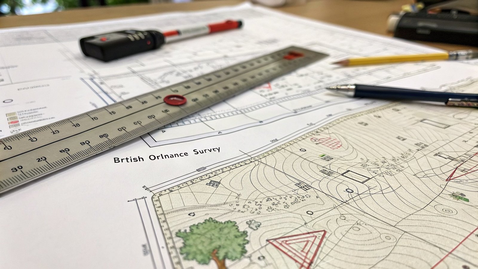
Step 3: Tree Survey Report Production
My Topographic Surveyor UK produces comprehensive reports including:
- Tree schedule: Spreadsheet listing all trees with measurements, assessments, and BS5837 categories
- Tree constraints plan: CAD drawing showing trees, RPAs, and constraints overlaid on site plan
- Written commentary: Arboricultural advice on development impacts
- Retention recommendations: Guidance on which trees to retain or remove
Tree survey reports are delivered within 10-15 working days for standard projects, with expedited options available for urgent planning applications.
Tree Survey Costs
Tree survey costs reflect site size, tree numbers, and survey complexity. My Topographic Surveyor UK provides transparent pricing:
- Small residential sites (5-15 trees): £400-£700
- Medium residential sites (15-30 trees): £700-£1,200
- Large residential (30+ trees): £1,200-£2,500
- Commercial developments: £1,500-£5,000+ depending on site size and tree density
- Tree Protection Plans: Additional £400-£1,000
- Arboricultural Method Statements: Additional £600-£1,500
Comprehensive BS5837 packages including tree surveys, protection plans, and method statements provide best value for planning applications requiring full arboricultural submissions.
FAQs: Tree Surveys and Planning
Do I need a tree survey for my house extension?
If your property has any trees (yours or neighbors') within falling distance of the proposed extension, planning authorities typically request tree surveys. Even if trees aren't protected by TPOs, planners want to see BS5837 assessment showing you've considered tree impacts. My Topographic Surveyor UK can advise whether tree surveys are needed for your specific extension plans.
How long does a tree survey take?
Site work takes 0.5-2 days for typical residential properties. Report production and delivery takes 10-15 working days. My Topographic Surveyor UK offers expedited services for urgent planning applications. Total turnaround from booking to receiving tree survey reports is usually 2-3 weeks.
Can I remove Category U trees without permission?
If trees are genuinely Category U (dead, dying, or dangerous), they can usually be removed for safety reasons. However, if trees are protected by TPOs or in Conservation Areas, you still need local authority consent even for Category U removals. Our experienced surveyors at My Topographic Surveyor UK provide Category U assessments that justify removal applications.
What happens if my development plans affect high-quality trees?
Planning authorities expect developments to be designed around high-quality (Category A and B) trees. You may need to modify building positions, reduce footprints, or implement specialized construction methods. Tree surveys from My Topographic Surveyor UK identify conflicts early, allowing design changes before submitting planning applications rather than facing costly redesigns after rejection.
Do tree surveys require tree climbing or specialist access?
Most BS5837 tree surveys are conducted from ground level. Our experienced surveyors assess tree health and structure from the ground using binoculars and professional judgment. Detailed tree inspections requiring climbing or aerial platforms are different services, typically commissioned for tree safety assessments rather than planning applications.
Can tree surveys be updated if my plans change?
Yes, if your development design changes after commissioning tree surveys, My Topographic Surveyor UK can update tree constraints plans and reports to reflect modified proposals. Updates typically cost less than new surveys since baseline tree data already exists. Contact our experienced surveyors to discuss survey updates for revised planning applications.
Why Choose My Topographic Surveyor UK for Tree Surveys
My Topographic Surveyor UK combines arboricultural expertise with professional survey equipment to deliver tree surveys that satisfy planning authorities across the United Kingdom.
- BS5837:2012 qualified: Surveyors trained in British Standard methodology
- Planning authority approved: Reports accepted by councils nationwide
- Professional equipment: GPS and total station positioning for tree locations
- Comprehensive reports: Tree schedules, constraints plans, and arboricultural advice
- Fast turnaround: Standard 2-3 week delivery with urgent options available
- Competitive pricing: Transparent quotes with no hidden fees
- Planning support: We liaise with planning officers to clarify tree survey requirements
Don't risk planning rejection due to inadequate tree surveys. Commission professional BS5837 tree surveys from My Topographic Surveyor UK and demonstrate to planners that your development protects valuable trees while achieving your building objectives.
Get Your BS5837 Tree Survey Quote
Contact My Topographic Surveyor UK today for a free quote on tree surveys, tree protection plans, and arboricultural method statements. Our experienced surveyors help your planning application succeed.
Request Free Tree Survey Quote